By Nick Houtman
This is what mass migration looks like on a map of the United States.
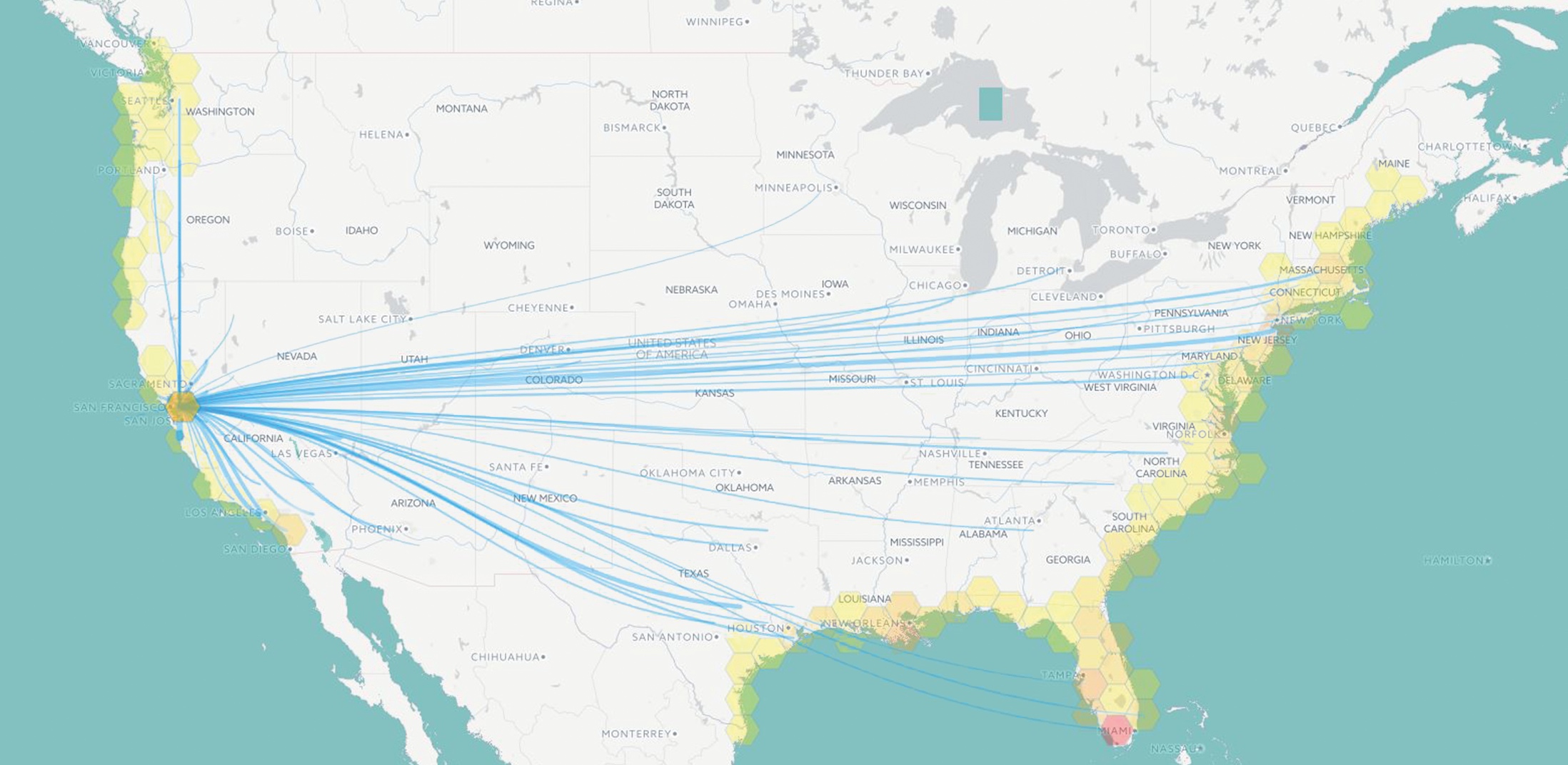
On a screen the size of a small theater, Oregon State University student researchers display the country’s coastline. Along every sea-washed state from New England to the Gulf of Mexico and up the West Coast, they run a chain of boxes like a pearl necklace around the perimeter of the continent. Each box represents a region such as Downeast Maine, southern Florida, Louisiana, the San Francisco Bay Area and Puget Sound.
 With a single click of a mouse on a box, Hoda Tahami sends a web of lines to other parts of the country. By clicking on Miami, for example, she launches threads running up the East Coast, into the Midwest and inland to the cities of the West and South. Each line represents a human outflow, a pathway of people based on records of actual migration between counties across the country.
In the future, the inexorable rise of average sea levels could trigger migrants to travel along these paths. Scientists such as OSU Distinguished Professor Peter Clark estimate that sea levels will continue to rise through this century well into the future, although just how much depends on how effectively emissions of greenhouse gases can be reined in. University of Georgia demographer Mathew Hauer has calculated that if seas rise 1.8 meters, just under 6 feet, more than 13 million people could be displaced in the United States. (Cornell researchers have estimated that globally, 2 billion people could be forced to move by the end of this century.)
Projecting that possibility for the United States, students in Oregon State’s geovisual analytics course (“geoviz” for short), created the migration map to show how the country’s population might shift. “I wanted to understand how sea level rise will affect people in their lives,” says Tahami, a Ph.D. student in geomatics, the practice of surveying and measuring the Earth’s surface.
“Sea level rise is not just a problem for coastal communities,” adds Nick Mathews, a graduate student in geotechnical engineering who participated in the project. “These people will have to move inland after they’re displaced. This will really reshape the population landscape. It was shocking to see it.”
Tahami and Mathews were joined by Efrain Noa-Yarasca, a Ph.D. student in water resources, and by Riley Johnson, an undergraduate in geography. Using data shared by Hauer, they worked with Bo Zhao and David Wrathall, assistant professors in the College of Earth, Ocean, and Atmospheric Sciences, to produce the map.
For their efforts, the students earned a first-place award in the 2017 Ecological Visualization contest funded by a National Science Foundation grant to the VISTAS project at Evergreen State College and OSU. View the map and see how migration routes vary across the country.

